
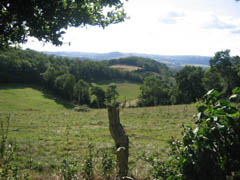
South of Caen, straddling the Calvados and Orne départements, the Suisse Normande ("Norman Switzerland") owes its name to a landscape that is surprising for the region: where they cut through the edge of the Armorican Massif, the Orne and its tributaries, the Rouvre and the Noireau, have carved deep gorges, cliffs and wooded hills. It is ideal mountain bike country, with short but steep climbs and descents through the woods.
The terrain
The highest point is Mont Pinçon (362 m), the summit of Calvados: altitudes stay modest, but the deep valleys soon add up to a lot of climbing. Routes alternate between the sunken lanes of the bocage (hedged farmland), forest singletrack, riverside paths and rocky viewpoints, such as the Roche d'Oëtre, a cliff about a hundred metres above the Rouvre gorges, or the rocks overlooking the Orne around Clécy.
The routes
The Suisse Normande is a mountain bike site approved by the French Cycling Federation (FFC). It has nearly 40 waymarked routes and around 800 km of trails, graded by colour from green to black, most of them red and black. They start from several villages: Thury-Harcourt-le-Hom, Clécy, Saint-Rémy-sur-Orne, Pont-d'Ouilly, Putanges-le-Lac, Falaise, Athis-Val de Rouvre and Saint-Philbert-sur-Orne.
For the fittest riders, the Tour de la Suisse Normande links 132 km and nearly 2,500 m of climbing from the Roche d'Oëtre. It is usually ridden over two days.
Several routes are designed for e-MTBs, such as route no. 39, a loop of about 26 km from Saint-Philbert-sur-Orne that follows the Rouvre gorges and passes the Ségrie mill.
For a gentler ride, the Suisse Normande greenway follows the Orne valley for about 40 km along a former railway line, and the Vélo Francette cycle route crosses the area through Thury-Harcourt, Clécy and Pont-d'Ouilly. Five waymarked cycling loops, from 13 to 41 km, complete the picture.
Who is it for?
- Families and beginners: the greenway, the cycling loops and the green routes.
- Cross-country: the blue and red routes, where steep climbs follow one another from one valley to the next.
- Experienced riders: the black routes and the Tour de la Suisse Normande, demanding for their amount of climbing.
- E-MTB: dedicated routes, shown on the Suisse Normande Outdoor website.
Practical information
- Maps and tracks: the routes are described on the Suisse Normande Outdoor website and in the app of the same name; a route guidebook is sold at the tourist office.
- On site: bike rental and guided rides with qualified instructors.
- Good practice: stay on the waymarked routes, give way to walkers, wear a helmet, and respect the private land and farmland you ride through.
- Getting there: the nearest airport is Caen-Carpiquet; Paris airports are further away. Caen has direct trains from Paris Saint-Lazare. Riders coming from the UK can take the Brittany Ferries crossing from Portsmouth to Caen (Ouistreham).
For other rides and events, see the pages Mountain biking in Calvados and Mountain biking in the Orne.
 Leave a review