
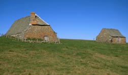
The GR 65, or Le Puy route (Via Podiensis), is the busiest of the Ways of St James (chemins de Saint-Jacques-de-Compostelle) in France. It runs for about 750 km from Le Puy-en-Velay to Saint-Jean-Pied-de-Port at the foot of the Pyrenees. Between the Haute-Loire and Cahors, its first half crosses the Margeride, the Aubrac, the Lot valley and the limestone plateaux (causses) of the Quercy. It is a walking trail: you can follow it on a mountain bike, but there is no waymarked cycling route and you share it with a great many walkers.
The terrain
Waymarked from 1970 by the French hiking federation (FFRandonnée), the GR 65 is the oldest Way of St James to have been laid out in France. From Le Puy-en-Velay it drops into the Allier gorges via Saint-Privat-d'Allier and Monistrol-d'Allier, then climbs back up to Saugues and the forests of the Margeride. Next come Aumont-Aubrac and the wide open spaces of the Aubrac plateau as far as Nasbinals, before the descent to the Lot valley and the abbey church of Conques. After Figeac the path crosses the causse via Limogne-en-Quercy, in the Causses du Quercy Regional Nature Park, to Cahors and its Valentré bridge.
The surface changes constantly: gravel tracks, dirt paths and tarmac roads. On some stages the climbs and descents follow each other relentlessly. In wet weather mud makes progress harder still, and the French agency for the Ways of St James (Agence française des chemins de Compostelle) considers the route harder by mountain bike in France than in Spain.
A smoother alternative
Between Figeac and Cahors, the Célé valley trail (GR 651) offers an alternative to the main route. The cycling guide to the Le Puy route published by Glénat follows the GR 65 as closely as possible, but uses the Lot valley between Conques and Figeac, then the Célé valley via Saint-Cirq-Lapopie down to Cahors.
Who is it for?
- Touring mountain bikers: several days on the move call for real fitness. The agency reckons on 60 to 130 km a day, or 4 to 8 hours in the saddle.
- Bikes: a hardtail or rigid mountain bike is well suited; a touring bike will do if you stick to the minor roads. An e-MTB makes the stages easier, as long as you check the battery range.
- Enduro and downhill: not in the spirit of the route, which is very busy with walkers.
Practical information
- Sharing the trail: the GR 65 is above all a path for walkers and pilgrims. Slow down, let them know you are coming and pass at walking pace, especially on narrow sections.
- Season: the agency advises setting off between March and October. On the Aubrac and the Margeride the weather can turn quickly.
- Preparation: the walkers' guidebooks (topoguides) describe the GR 65 in detail. Study the elevation profile before you go and carry what you need to repair your bike on your own, lights included. A helmet is strongly recommended.
- Accommodation: hostels (gîtes) and B&Bs line the route; the agency recommends places with the Accueil Vélo label, which have covered bike storage.
Getting there and back
- Le Puy-en-Velay has a regional (TER) train station, with direct trains from Saint-Étienne, Lyon and Clermont-Ferrand; high-speed (TGV) connections are at Saint-Étienne and Lyon. The nearest major international airport is Lyon-Saint-Exupéry.
- Cahors is on the Paris–Cahors–Toulouse main line, served by Intercités trains. Toulouse-Blagnac airport is about 1h30 away, and Brive-Vallée de la Dordogne airport is another option.
- Your bike: dismantled and packed in a dedicated bag, it travels as hand luggage on TGV INOUI trains. Courier companies, and some tourist offices or associations, can also send it home as a parcel; book this before you set off.
For other rides and events in the départements along the way, see Mountain biking in Haute-Loire and Mountain biking in the Lot.
Useful links
- Agence française des chemins de Compostelle – the Le Puy route (in French): map, accommodation, variants
- Agence française des chemins de Compostelle – travelling by bike (in French): advice, equipment, transporting your bike
- FFRandonnée – the GR 65 from Le Puy-en-Velay to Nasbinals (in French)
- Cahors – Lot Valley tourist office – the Le Puy route (GR 65)
- Le Puy-en-Velay Tourisme – getting there (in French)
- Lot Tourisme – getting to the Lot (in French)
 Leave a review